05/30/2024
NOAA Partners With Meteomatics To Enhance Weather Forecasting

Sr. Content Marketing Manager
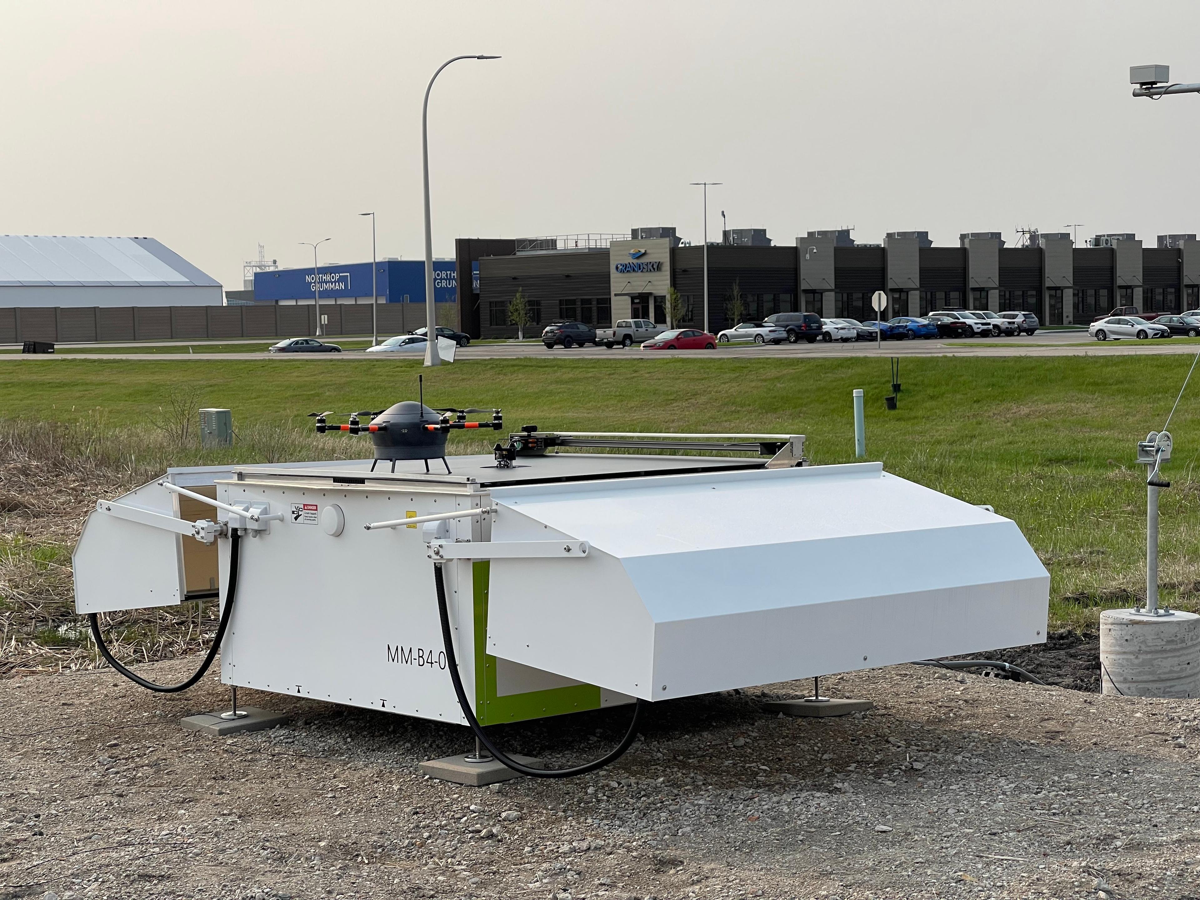
In partnership with NOAA, GrandSKY, Synoptic Data PBC and Meteomatics will deploy Meteodrones at the GrandSKY Aviation Park in North Dakota to gather observations at high altitudes to enhance forecasting.
NOAA, the National Oceanic and Atmospheric Administration, is the United States' primary agency for providing critical environmental intelligence. It oversees the National Weather Service and plays a key role in weather forecasting, climate monitoring, ocean and coastal conservation, and environmental research.
NOAA and GrandSKY have signed a two-year Cooperative Research and Development Agreement (CRADA) to deploy Meteomatics' Meteodrones. The goal is to gather and evaluate upper air data to improve weather forecasting. This collaboration underscores NOAA's commitment to working with private sector companies through CRADAs to conduct mutually beneficial research and development.
These public-private partnerships are vital for integrating private sector innovation and agility into NOAA's research efforts.
The research project will be conducted at the GrandSKY Flight Operations Center in Grand Forks, North Dakota. Meteodrones will do high-altitude vertical profiles, addressing critical gaps in weather observation in that area. These high-resolution insights are expected to enhance forecast accuracy significantly.
“Additional observations in the atmospheric boundary layer, at many vertical points above Earth’s surface, are key to improving the skill of National Weather Service forecasts and warnings,” said Curtis Marshall, Ph.D., Lead for the Commercial Data Program at NOAA’s National Weather Service. “We are exploring commercial sources to improve our observing systems footprint and through this partnership, we hope to leverage a new way to gather the observations we need.”


Lead for the Commercial Data Program
NOAA
Additional observations in the atmospheric boundary layer, at many vertical points above Earth’s surface, are key to improving the skill of National Weather Service forecasts and warnings.
Martin Fengler, CEO and Founder of Meteomatics, highlighted the importance of this collaboration: “Meteodrones significantly enhance the accuracy of weather forecasts by filling critical observation gaps in the lower and mid-atmospheric boundary layer. Offering precise, high-resolution data revolutionizes our ability to predict severe local weather phenomena. Thus, we are very excited to be part of this forward-looking project and to work with great partners on the future of advanced weather forecasting.”
Meteomatics’ Meteodrones are the backbone of this project, providing unprecedented data that is instrumental in improving situational awareness and enhancing forecast accuracy. This partnership marks a significant step forward in the integration of advanced technology into weather forecasting, promising to bring substantial benefits to the field.
A More Reliable, Cost-Effective and Sustainable Alternative to Radiosondes
Meteodrones are a viable solution to the limitations associated with traditional radiosondes in weather forecasting and atmospheric research. With their ability to reach altitudes of up to 6km, conduct controlled flights, and gather data more comprehensively and reliably, Meteodrones offer a superior alternative. As Meteodrones continue to evolve and gain acceptance within the meteorological community, they can revolutionize atmospheric data collection and enhance our understanding of weather dynamics for years to come.


Expert Call
Let’s Find the Perfect Solution to Your Problem. Talk to an Expert.
Related Articles


We provide the most accurate weather data for any location, at any time, to improve your business.